A new Indian Ocean record for Caudrelier, Le Cléac’h charge continues and The Sunday Question: The Ice exclusion zone, how does it work?
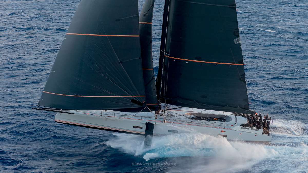
Two hundred miles SW of the southern tip of South Island, making 34 knots in the Pacific Ocean, fresh from setting a new solo sailing record for the passage of the Indian Ocean, Charles Caudrelier must also be reflecting that he is fast approaching the half way point of his ARKEA ULTIM CHALLENGE Brest solo race around the world.
ARKEA ULTIM CHALLENGE-Brest solo round the world race leader Charles Caudrelier sailed into the Pacific Ocean last night after setting a new solo record time for the passage of the Indian Ocean between Cape Agulhas in South Africa and the longitude of Tasmania.
On the Maxi Edmond de Rothschild Caudrelier passed Cape South East, the Tasmanian longitude at 00:03:10hrs UTC this Sunday morning. With a passage time of 8d 8h 20′ and 36′, the 49 year old French skipper broke Thomas Coville’s 2016 record by 3hrs 57 minutes. Caudrelier’s average speed in the Indian Ocean has been a remarkable 30.7kts.
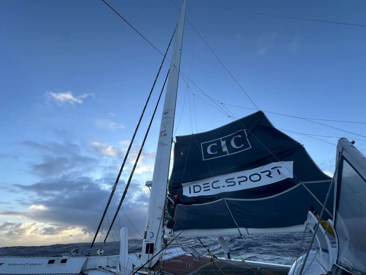
The absolute record for the Indian Ocean is held by Francis Joyon at exactly seven days. Joyon sailed IDEC Sport with a crew of six and, unrestricted by any ice limits such as the AEZ imposed on this course, sailed very much further south and therefore covered a shorter distance. At the time, December 2015, Joyon smashed the newly set record of Spindrift 2 by nearly 33 hours.
And, also subject to approval by the WSSRC, Charles Caudrelier has already set one transoceanic record on this race. On Thursday January 25, the skipper of Gitana Team also set a new best solo reference time between Ushant and Cape Leeuwin. He improved on the time established by François Gabart in 2017 by 1d 8h, 25′ 55”.
Caudrelier was making a steady 32 knots this morning in the Pacific and sees his lead grow to nearly 1900 miles over second placed Thomas Coville (Sodebo Ultim 3) who is about 110 miles from Cape Leeuwin this evening. Armel Le Cléac’h (Banque Populaire XI) continues to close miles on second place.
Yesterday at 1504hrs UTC Anthony Marchand returned through the reference gate to complete his technical stopover and resume racing. His technical team members took full advantage of the 24 hours minimum stopping time and removed Actual Ultim 3’s damaged port foil, but also repaired anything else that needed attention “The objective was to leave while respecting the minimum stopover time imposed by the race regulations, and we achieved,” enthused Marchand from the race course. “The guys worked tirelessly from the moment the boat arrived. Everything happened extremely quickly but everything is now back in working order. The boat is not leaving at 100% of its potential but it is leaving strong, which is essential for me before starting the crossing of the Indian and Pacific Oceans.”
He crossed paths with Adagio which was on its way in to Cape Town. Since Éric Péron said he would make a stopover, his technical team has been hard at work. Coach Elliott Le Dem headed to South Africa on Friday; the same day, the part to be replaced in the rudder system was delivered after machining. Next day boat captain Loïc Le Mignon left Brest for Cape Town, the part in his suitcase. And yesterday, Éric Péron reached Cape Town, which he was expected to leave at 1757hrs UTC this Sunday, in accordance with the 24 hour minimum, which he and his team fully expect to have adhered to.
ARKEA ULTIM CHALLENGE-Brest.
The Sunday Question: The Ice exclusion zone, how does it work?
THE SUNDAY QUESTION. Every Sunday, we try to offer a new insight, develop a concept, or drill down into a key topic. Today we look at the ‘what and why’ of the ZEA, the Antarctic Exclusion Zone which is a limit line not to be crossed by the skippers.
It is set up to protect the solo racers from icebergs which drift in the south of the Indian and Pacific Oceans. This demarcation line is fixed by the Race Direction according to the recommendations of CLS (Collection Location Satellites) which are regularly updated. With four skippers currently race along this ZEA, Jimmy Viard, satellite imagery analyst at CLS, explains the challenges.
Why is this ZEA necessary?
Our objective is to provide race management with all the elements to fix the correct position of the ZEA. Three months before the race, we collect data using altimetry (use of a technique designed to finely measure variations in ocean levels), radar and optical imaging. This allows us to determine the areas of risk in terms of the quantity of icebergs. We then present our results to Race Direction. During the race, we can refine the ZEA by using radar satellite imagery which allows us to determine the positions of the icebergs. We are already on the 4th update since the start.
You modified it recently?
Yes, last weekend for the area by the Kerguelens. Because of the analysis of satellite images, three detections of 40 meter objects were observed. These might indeed be boats which do not use AIS (an anti-collision system fitted and used by all vessels and which allows them to be identified) as they are fishing illegally. We didn’t want to take any risks at all and so we decided – in collaboration with the Race Direction – to move the line up to the north just a bit.
“Icebergs can exceed 10 km!”
As well as observing icebergs, you model them?
Yes totally, we model icebergs. By determining their volume and height and knowing the currents, winds and water temperature, algorithms are able to model their drift for several days. It is very reliable for three days, less precise after that. This allows us to anticipate their drift and ensure that no iceberg is actually close to the ZEA.
How big are these icebergs?
The bergs we detect can exceed 10 km, or sometimes more than 100 km. These are pieces of Antarctic glacier which drop into the sea which break up and which manage to extricate themselves from the ice floe and come north on the current. Larger ones are renamed with a letter and number by the United States National Ice Center. As they drift, mainly with the currents (and to a lesser extent with the wind), they break up into large pieces. We can see and monitor pieces of ice at 40 meters and bigger. Below it becomes complicated since they can be confused by breaking waves.
Are there more or less than in previous years?
This year in the South Atlantic, it’s a real minefield full of icebergs! Some managed to escape because of the current, others broke apart as the water warms up. In the Atlantic, there is a current from West to East which takes them from the Antarctic Peninsula and they drift towards the Kerguelens and ‘die’. In the Pacific, they come from the Ross Sea to Cape Horn. It depends each year on the number of icebergs that leave Antarctica and that varies greatly. In the Pacific, for example, we are seeing significantly fewer icebergs this year than last year.
“They are not going further north than usual”
Does global warming have an impact on this?
In truth we do not really know from the sphere of our work if this is due to climate change. On the other hand, what we see is that the blocks released from the glaciers are increasingly larger. If the block extricates itself thanks to the current and manages to get out to the North before winter imprisons it, it will advance, fracture and continue on its way. Sometimes, it can “live” an entire year or even years in the South Atlantic. However, they do not go further north than usual, around 44° South in the Atlantic.
During their record attempts, Thomas Coville and François Gabart went much further south than our skippers?
Yes. Totally, but these are two different things, racing and going for a record. The round-the-world record attempt has no limit imposed on the course. There we work directly with routers. Here the Race Direction has a responsibility to ensure the safety of the skippers, hence the need to establish the ZEA, and then the ZEA must remain valid for the last competitor who might pass a long time after the leader.
What could be optimized or improved in the future in this field of work?
We currently use commercial images of 500kmx500km with a resolution of 80 meters by programming them precisely where you want. We also use data from the European Sentinel satellite on areas defined well in advance by the Copernicus program but coverage in the big south is weak. There would need to be a satellite mission that permanently programs images before and during the race. The costs are still substantial.
For more information https://www.cls.fr/en/
Text Credits: ARKEA Ultim Challenge
To keep up to date with ARKEA ULTIM CHALLENGE, please visit https://www.arkeaultimchallengebrest.com follow on:
Instagram: @arkeaultimchallengebrest
Facebook: @arkeaultimchallengebrest
#ARKEAULTIMCHALLENGE


